The granitic rock exposed along the shoreline of the Reserve forms part of a larger mass of granite (actually closer to a monzonite to granodiorite in strict geological terms), known as the Stanstead Pluton. This igneous intrusive (aka “plutonic”) rock is areally-restricted to the southern part of Ogden and is almost exclusively exposed north of the border. Since about 1868 it has been commercially exploited as a building and monument stone. The Stanstead Pluton is relatively small but is part of a suite of numerous, broadly similar igneous intrusive bodies that stretch in a northeasterly fashion from Connecticut to the Gaspé. Most of these granitic plutons were emplaced in the Devonian Period of geologic time, about 360 to 335 million years ago. Typically they were intruded into the surrounding rock at a great depth below the surface (kilometres deep) but are now exposed at the surface due to tectonic forces and millions of years of erosion.
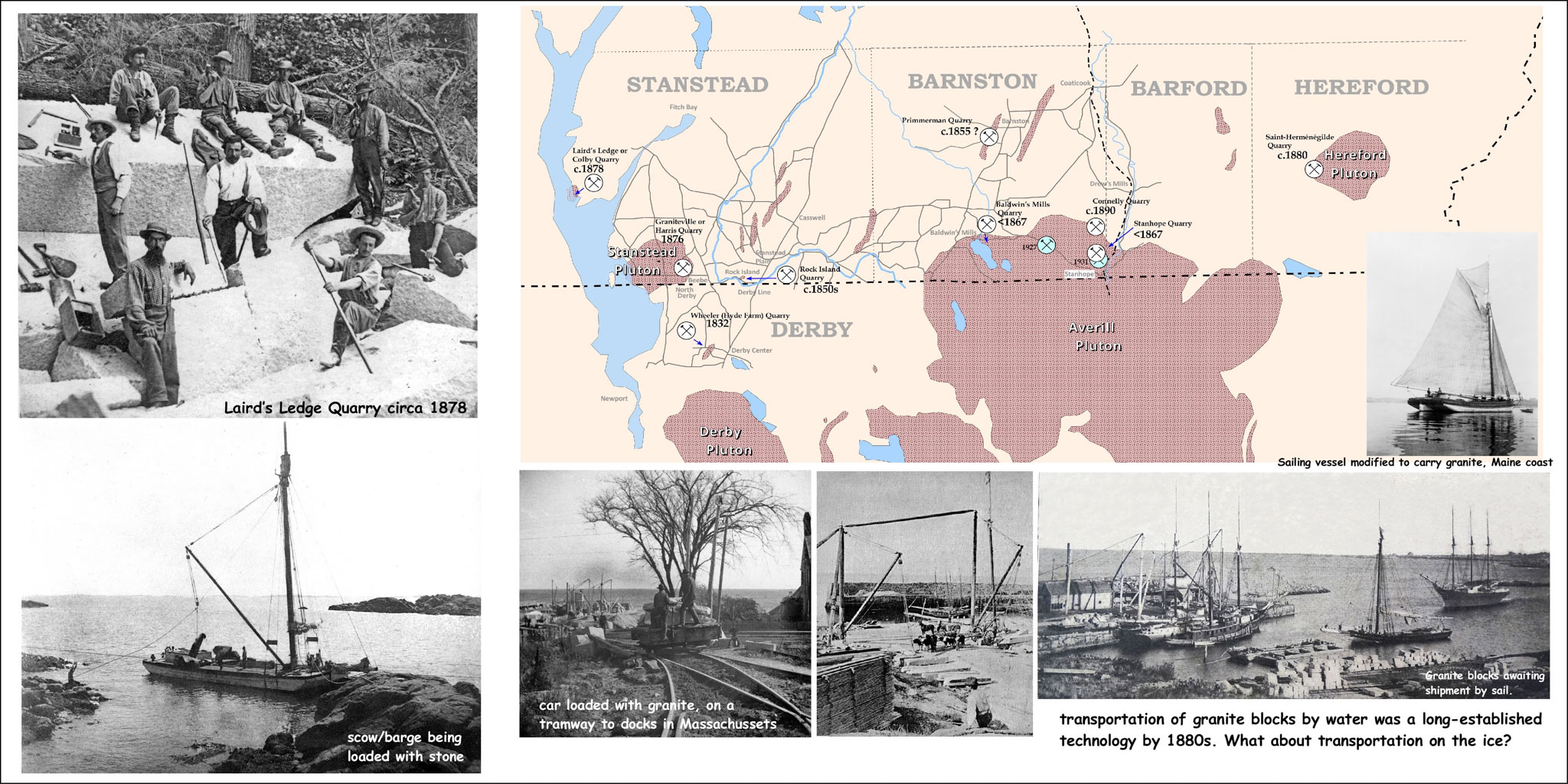
Shipping this bulky heavy material in the 19th century was a challenge but shipping in specially designed ships and barges was far easier than moving it overland. Shoreline quarries were thus greatly valued and the Dunn Reserve lands were viewed as having great promise. Further north on Lake Memphremagog a smaller granite deposit had already been exploited at Laird’s Ledge opposite Long Island. The granite there was destined for the new dam being constructed at Magog. The dam was completed in 1883 and the quarry abandoned. This is often the nature of quarries. They are opened to serve a specific need and shut down once that need has been met or the quarry has become uncompetitive.