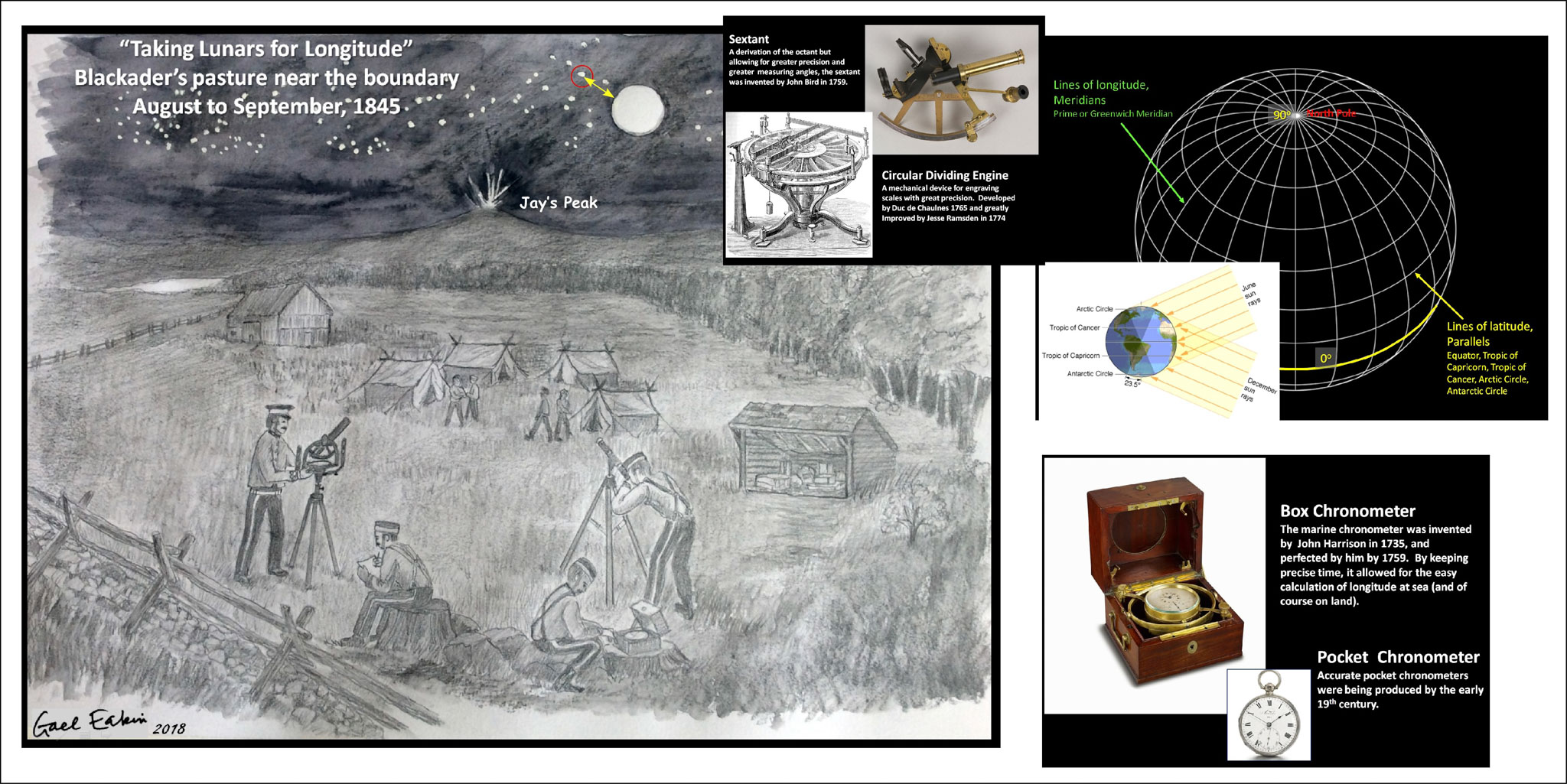
In accordance with the Treaty of Washington, starting in 1843 the boundary between the US and British North America, extending from the headwaters of the St Croix River in the east to the Lake of the Woods in the west, was re-surveyed by both an American Commission and a British Commission. At times the Commissions worked independently, at other times they worked jointly. By all accounts the collaboration was both sincere and quite fruitful. By the summer of 1845 the teams were working to find the old 1772 Collins-Vallentine line and re-survey it. The boundary had to be situated in terms of both latitude and longitude. By the 1840s the former was relatively trivial to accomplish, the latter however required precise measurements, both astronomical and chronometric (time). In Ogden, in a pasture about 1017 ft north of the border line, and apparently “….some 345 feet northwest of the barn on Blackader’s farm…” the British set up a temporary astronomical station (observatory). The barn has long disappeared and the pasture is now quite dense secondary forest.
A separate team was sent out to ascend Jay’s Peak and erect a tall platform at the summit where gunpowder charges were set. At a pre-agreed date and time, contingent on clear skies, warning charges were set off and then a large full charge. When the full charge was ignited simultaneous observations were made of ‘lunars’ at Ogden as well as at other stations with a view of Jay Peak. Nine such observations were taken on separate evenings. Lunars were very precise measurements of the angular distance (in degrees, minutes and seconds) between a specific star and a near-space object, in this case the edge of the moon. The difference between these lunars taken at precisely the same time could be calculated to differences in longitude between the stations.