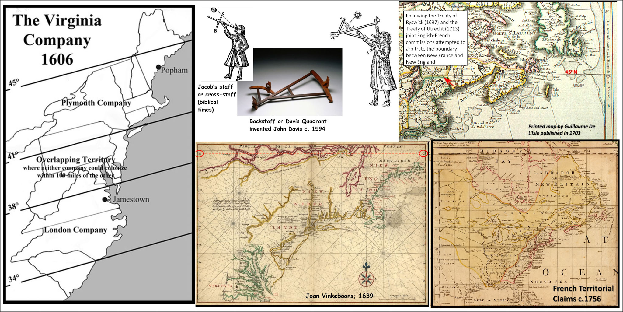
It was recognized quite early on (at least the 1400s) that the peak height of the sun above the horizon (i.e. solar noon) on a given date, corresponded to one’s latitudinal position. This was vital as ships sailed into the vastness of the Atlantic and wanted to know how far north or south of their intended bearing they might be drifting. The replacement of the Jacob’s staff, which required direct sighting of the sun, by the Davis Quadrant or backstaff (indirect sighting) was a great boon as it meant far fewer sea captains were going blind (burned out retinas). True story!
Latitudes were also convenient for rulers who sponsored voyages of discovery and made territorial claims. From the relative safety and comfort of one’s throne room one could make generous territorial claims based on imaginary lines that nobody really understood but few could contest (especially the indigenous people whose land you were neatly carving up). The reason that our present international boundary sits close to the 45th Parallel is simply because this was the arbitrary northern latitude granted by James 1st of England for the charter of the Virginia Company in 1606. The Dutch in 1614 also chose the same latitude for their northern boundary for New Netherland. The French too flirted, albeit informally, with the 45th parallel as the southerly limit to New France. The simple passage of time (and some nasty conflicts) hardened these cartographic abstractions into accepted geopolitical realities.