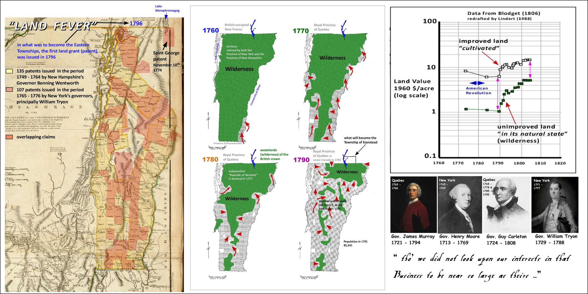
A conceptual boundary is only so useful. Eventually someone is going to want it marked on the ground. In the case of the 45th the impetus was greed. In the 1760s through to the mid 1770s, Royal Governors of the Provinces of New Hampshire and New York were doling out grants of land like candy to children, often in competition with each other. In what would eventually (in 1791) become the State of Vermont, this speculators’ land fever quickly plastered nearly all of this wilderness territory in rival patents (map upper left) driving up land prices for both improved and unimproved (uncleared) parcels dramatically (chart upper right). Both old provinces laid claim to the territory. The successive governors of New York, Henry Moore and then William Tryon, approached the governor of the ‘new’ royal province of Quebec (Guy Carleton) to demarcate the border of their adjoining provinces on the ground. Settlement of the territory was proceeding quickly (map upper middle) and both speculators and the settlers themselves wanted to know where their land claims actually lay with respect to the boundary. This was entirely driven from folks south of the boundary. As stated by Quebec, ‘ ... tho’ we did not look upon our interests in that Business to be near so large as theirs...’, Quebec provisionally agreed to pay half the costs.