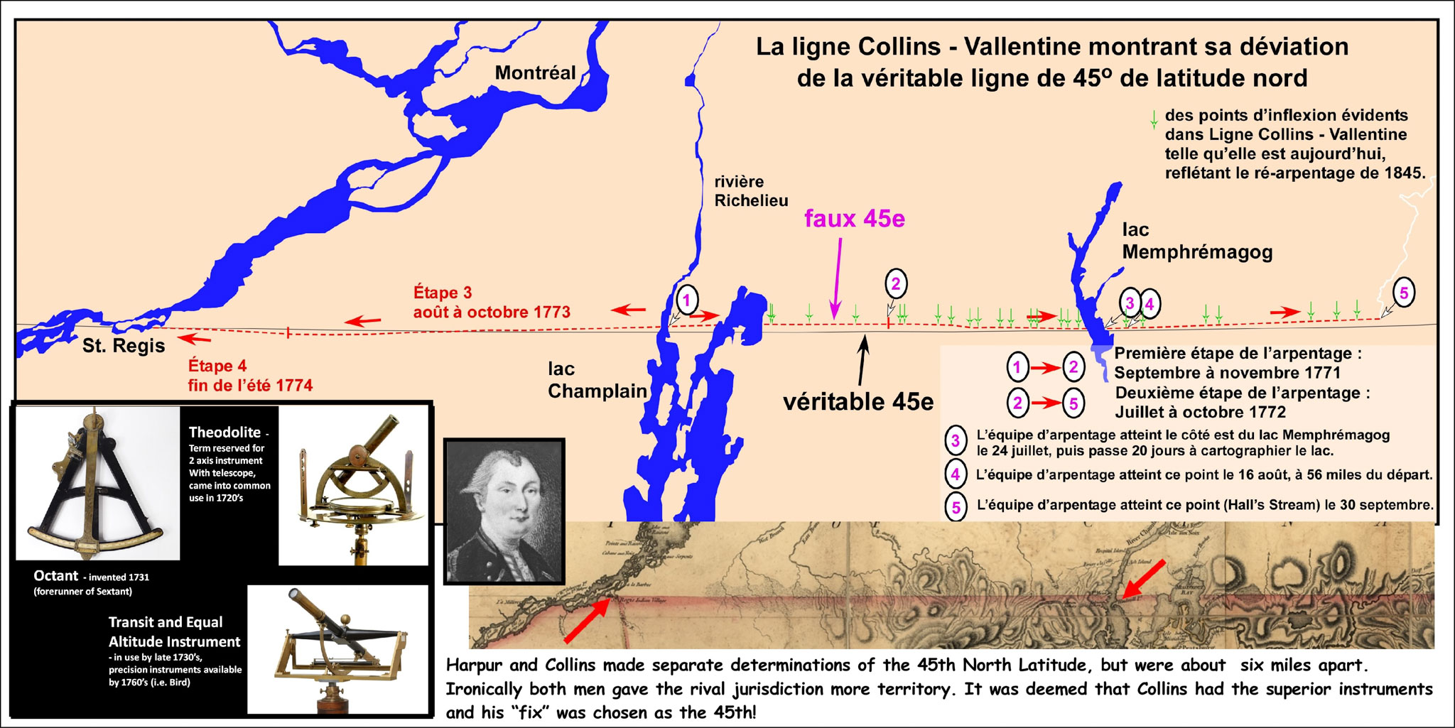
In the summer of 1769 the governors of New York and Quebec met on the eastern shore of Lake Champlain (Richelieu River) near Windmill Point. They each brought with them skilled men along with their best survey instruments (lower left). Their mission was to independently come up with a ‘fix’ for the 45th parallel where it met the eastern shore. Thence, in theory, a line could be cut in either an easterly or westerly direction using simple surveyors circumferentors (magnetic compasses). Robert Harpur, a mathematician from King’s College was the New York expert. John Collins, Deputy Surveyor-General for the northern district of British America was the Quebec man. Neither observations nor instruments were up to the task. When the observations had been made and the calculations concluded, the two mens’ results were an astonishing six miles apart! Ironically both men would have yielded territory to the other jurisdiction. In the end, and in an entirely unscientific and arbitrary fashion, Collins instruments were deemed superior and therefore his fix was chosen as the true 45th !
Between 1771 and 1774 a line was surveyed and cut through some 256 km of wilderness. The only consistent player in the boundary line work was John Collins. No American lasted longer than a single field season and indeed on the last stage in 1774, no American could be found at all and Collins was asked to do the job for both governments.
Although much is made of the errors of the surveyed line from the true 45th, given the problems of the initial fix, the inability to account for local magnetism deflecting the compass needle, the imprecision of the instruments, and the general conditions encountered in rugged terrain and utter wilderness, the Collins-Vallentine Line is a most impressive feat.